
South Buckingham Court, in Sterling Park, Virginia, runs out of road a little way short of Cabin Branch. On a map it takes barely a flick of the pen to get there. Turn off East Poplar Road, head toward the creek, and you’ve already reached the little bulb where a driver can turn around.
Try finding that turn on the 1966 map below. The houses in the upper left are a good place to get your bearings. A diagonal boulevard passes the rows of houses. Downhill, the name Cabin Branch follows a blue thread across the page. Keep your eye on the space between the straight dashed line and the creek. Now switch editions. Can you pick out the two little dead ends that point toward the water? Look at the one on the right before you open the margin.
Read the mapmaker’s margin

“Revisions shown in purple compiled from aerial photographs taken 1971. This information not field checked”
The next line assigns the pale purple tint to urban areas. The darker pair of lines that dips toward the creek outlines the street. Count the two short dead ends from the left. South Buckingham Court is the second.
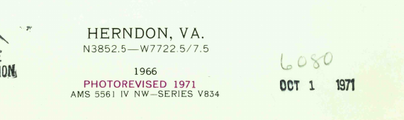
Both margin details from the same 1971 USGS revision, scan 185355.
Two jobs for one ink
The older map gives you plenty to follow through this patch of Virginia. There’s a bend in the creek, a slope picked out in brown contours and that straight line cutting across both. The full sheet labels the line “PIPELINE” a little farther east. In the revised view you can still trace all three. Somebody has fitted a neighborhood into the spaces between them.
There are two purples here, and the paler one is easy to mistake for the important one. It spreads across a whole piece of Sterling Park like a berry stain. In the margin the Survey assigns that tint to urban areas. A wash of color alone would tell you very little about where to make a turn. For that you need the fine paired lines. Follow the pair running across the middle, then the short pair branching off it. The ink goes around the end of the court and comes back up the other side.
Neither little court has room for a printed name. To put a name to the right-hand one, we matched the junction and the round end to the U.S. Census Bureau’s road file for Loudoun County. It places Poplar Court to the west and South Buckingham Court to the east, both off East Poplar Road. Those are names from a modern record. What you can see for yourself on the old sheet is the shape.
Why the map still says 1966
If you filed the two full sheets by the big black year under Herndon, Va., you’d put them in the same drawer. Both say 1966. Read the smaller type on the earlier one and you find that the mapmakers had already worked from photographs taken in 1964 and checked the map in the field in 1966. The later sheet keeps that history. Directly under the black year it adds another line in purple, “PHOTOREVISED 1971.”
Photorevision let the Survey give someone using an older map the benefit of a newer flight. A mapmaker could pick out a street where the previous sheet showed open ground and carry its outline onto the map. Sending a survey party back over the quadrangle was a different undertaking. The Survey’s account of its revision program says it used purple so readers could tell which features had been added without the full checks of new mapping. Here, the printer even put the explanation in the ink it explains.
So when could you first have driven down South Buckingham Court? The map gives us a narrower answer than a driver might like. The court is missing from this 1966 edition. Its outline appears in the revision made from the 1971 photographs. A street can be visible from the air before anyone is allowed to drive it, and a road can exist for a while before it finds its way onto paper. To put a year on the paving, you’d want a dated construction or inspection record for this stretch. Even a subdivision plat could show what a developer intended to build.
There’s a similar surprise in the margin of the Crater Lake map. A dashed route looks promising until you read what the surveyor said about taking a pack train that way. In Sterling Park, the small print lets you picture a different vantage point. Look back at the end of the court. The view the mapmaker had of that turning circle was from overhead.