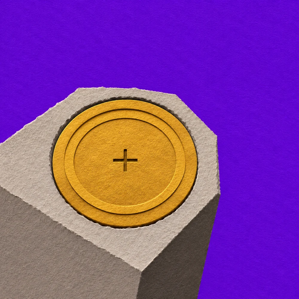
At a railroad crossing southwest of Park City, Kentucky, the top of a concrete post stood just three inches out of the ground. Surveyors described it in 1968. They put down the distance to the nearest rail, the fence and even two telephone poles. They also noted which way a gravel road ran. Of all those details, the gravel road is the one you can still put to work on a paper map.
The map is a U.S. Geological Survey sheet revised in 1966. Follow the Louisville and Nashville Railroad across it and you’ll pass little black crosses with BM beside them. The letters stand for bench mark. The number beside each cross gives the elevation of a particular point a surveyor could put a rod on. Two of those crosses lie just east of road crossings. Here’s enough of the crew’s description to tell them apart.
Which crossing fits the field note?
Both maps have north at the top. The railroad is the straight black line with short bars across it. Look just east of each crossing.
The disk lay east of a road crossing, 50 feet southeast of the nearest rail. A gravel road ran alongside the track. The disk was 11 feet southeast of the middle of that road.
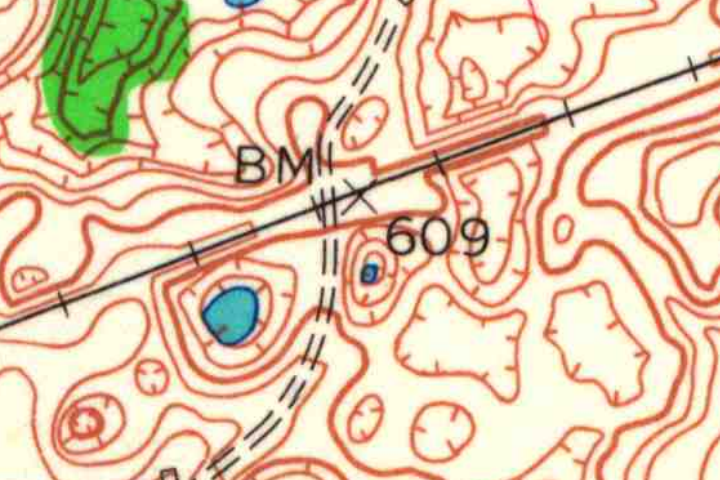
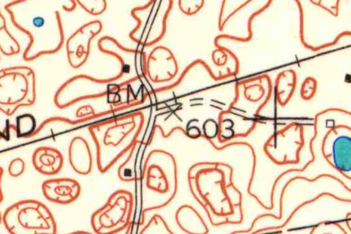
Two details at the same enlargement from the USGS Park City, Kentucky, sheet revised in 1966. Public domain. The crosses and numbers are original. Inspect the full Kentucky map (PDF).
Check the survey record
A has a crossing, too. Trace the dashed road through it. The road heads away from the tracks on both sides.
You found the lane. Its two broken lines fit in the narrow space between the lettering and the railroad.
Crossing B, BM 603. Start at the x above the 6 and trace the lane to the right. For a short stretch it shares the railroad’s direction before curving away. The survey crew placed the disk just outside that lane. The older surveyed height was 603.01 feet.
The disk was stamped C 345 1953. You can find it in the National Geodetic Survey’s records under permanent identifier HA0129. Crossing A has its own disk, E 345, with an older height of 609.37 feet.
What the disk actually said
The crew put the disk 119 feet east of the crossing. At the original map scale, that distance takes up about a millimetre and a half of paper. The eleven feet from the middle of the gravel lane to the disk gets less than the width of a pencil line. The cross gets you to the crossing. The written distances take over from there.
The Coast and Geodetic Survey set the disk in 1953. There are two numbers in the stamping recorded on its face. One, 345, goes with the letter C to identify the station. The other is the year. If you went looking for the number printed on the map to be stamped into the metal, you could have the right disk under your thumb and keep looking.
Even the nearby railroad would give you a different number if you measured the wrong thing. According to the field description, the disk sat about six feet below the track. On this sheet a brown contour stands for a ten-foot step in elevation. The difference between the rail and the disk is small enough to fit inside one of those steps, yet big enough to matter a great deal to the next person setting up a level.
Picture two upright measuring rods with a level between them. Looking along the same level sightline, a surveyor reads higher up the rod whose foot stands lower. The difference between the readings gives the difference in height. Move forward in stages and those differences carry a height from one known point to the next. Leaving a disk gives another crew a place to set the foot of its rod years later. “Somewhere near the crossing” would undo much of that work.
One disk, two published heights
The old sheet gives the height to the nearest foot. The station record keeps more digits, and it keeps the name of the reference system that goes with each measurement. Surveyors call that reference a vertical datum. In the part of the record headed Superseded Survey Control, the height on the National Geodetic Vertical Datum of 1929 is 603.01 feet. That rounds to the number on the map. The map margin calls its reference “mean sea level.”
Farther up the same record, the height on the North American Vertical Datum of 1988 is 602.65 feet. The difference comes to a little over four inches. Those two entries express the height on different datums. Subtracting them won’t tell you that the post sank four inches into the gravel. In fact, both heights round to 603. You need the crossing and the lane to make the match, and the datum to say what the finer digits mean.
The last time someone found it
On October 17, 2005, GRW Aerial Survey reported finding the disk in good condition. That is the latest recovery in the National Geodetic Survey record checked for this story. The map coordinates in that same record were estimated from a map. The surveyors could give a height to hundredths of a foot and still have good reason to write down which side of a gravel lane to look on.
For another way to read those little elevation numbers, try counting the spaces between contours at Crater Lake. There you can work out the climb across a stretch of ground. Here the whole survey comes down to a spot small enough for the foot of a measuring rod.